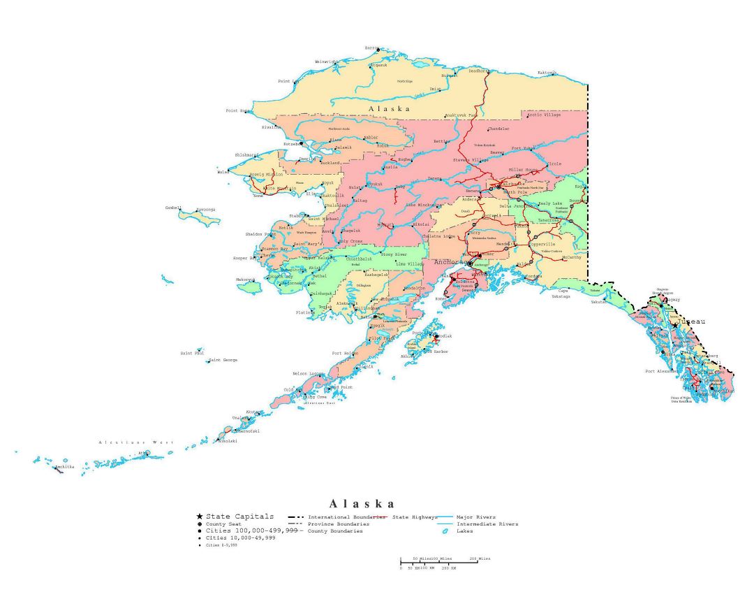
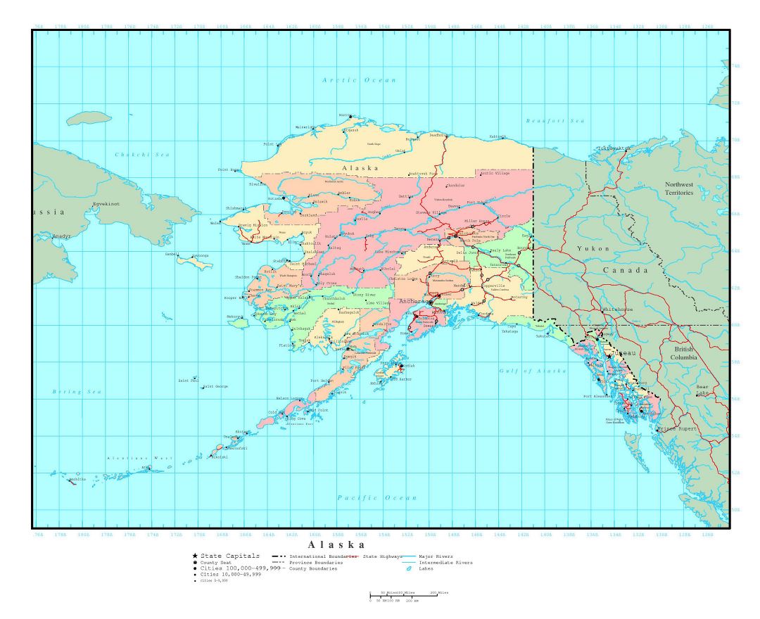
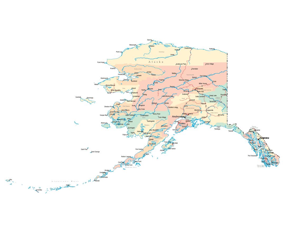
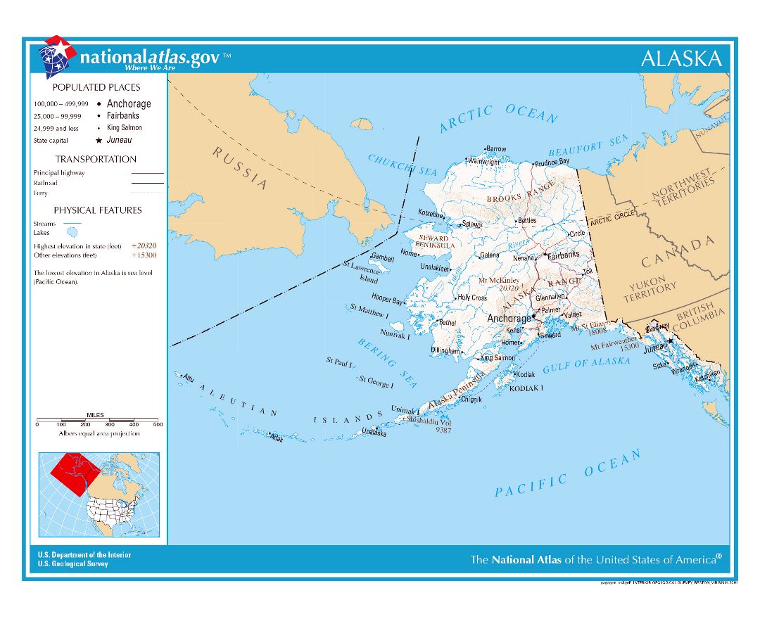
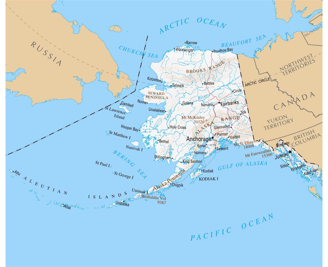
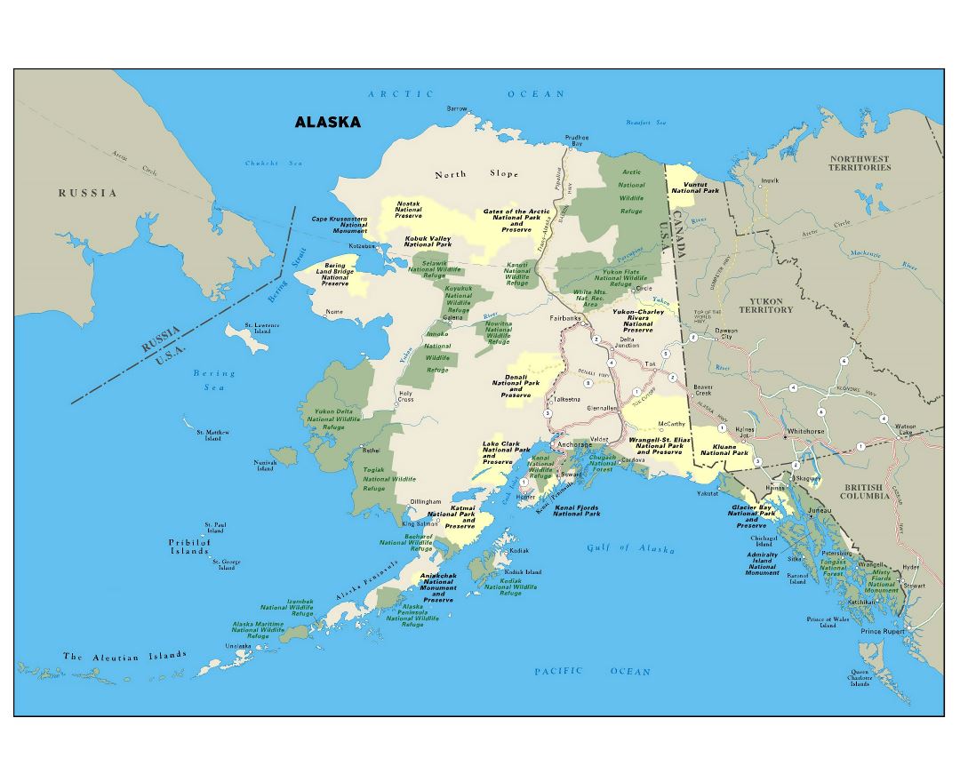
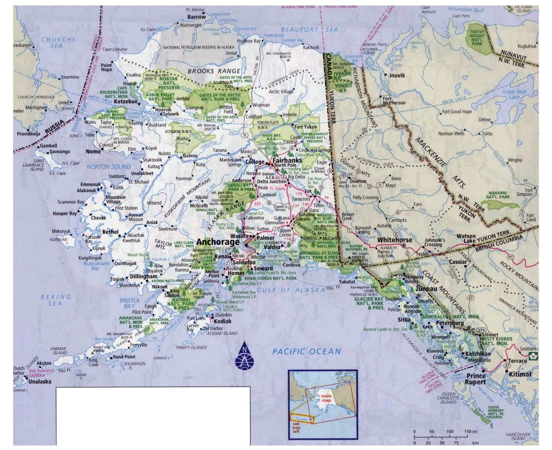
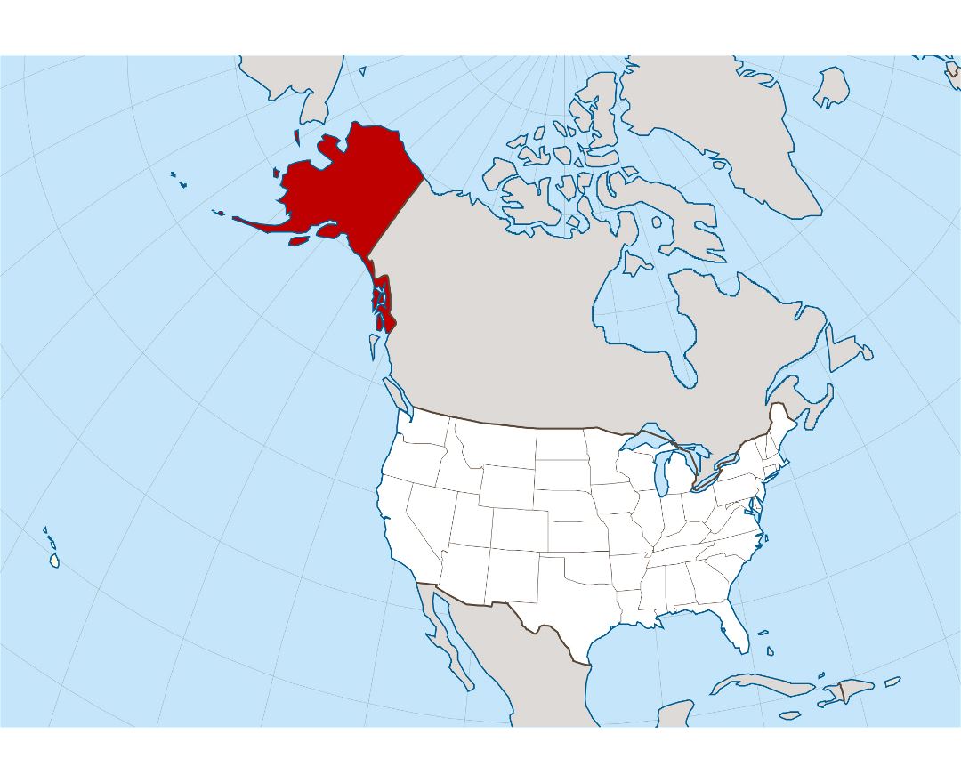
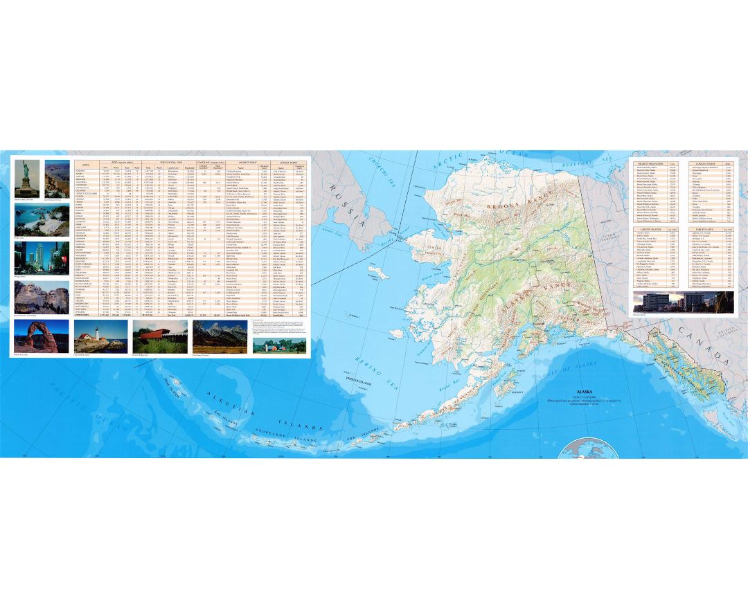
Alaska state
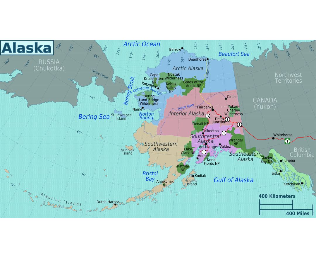
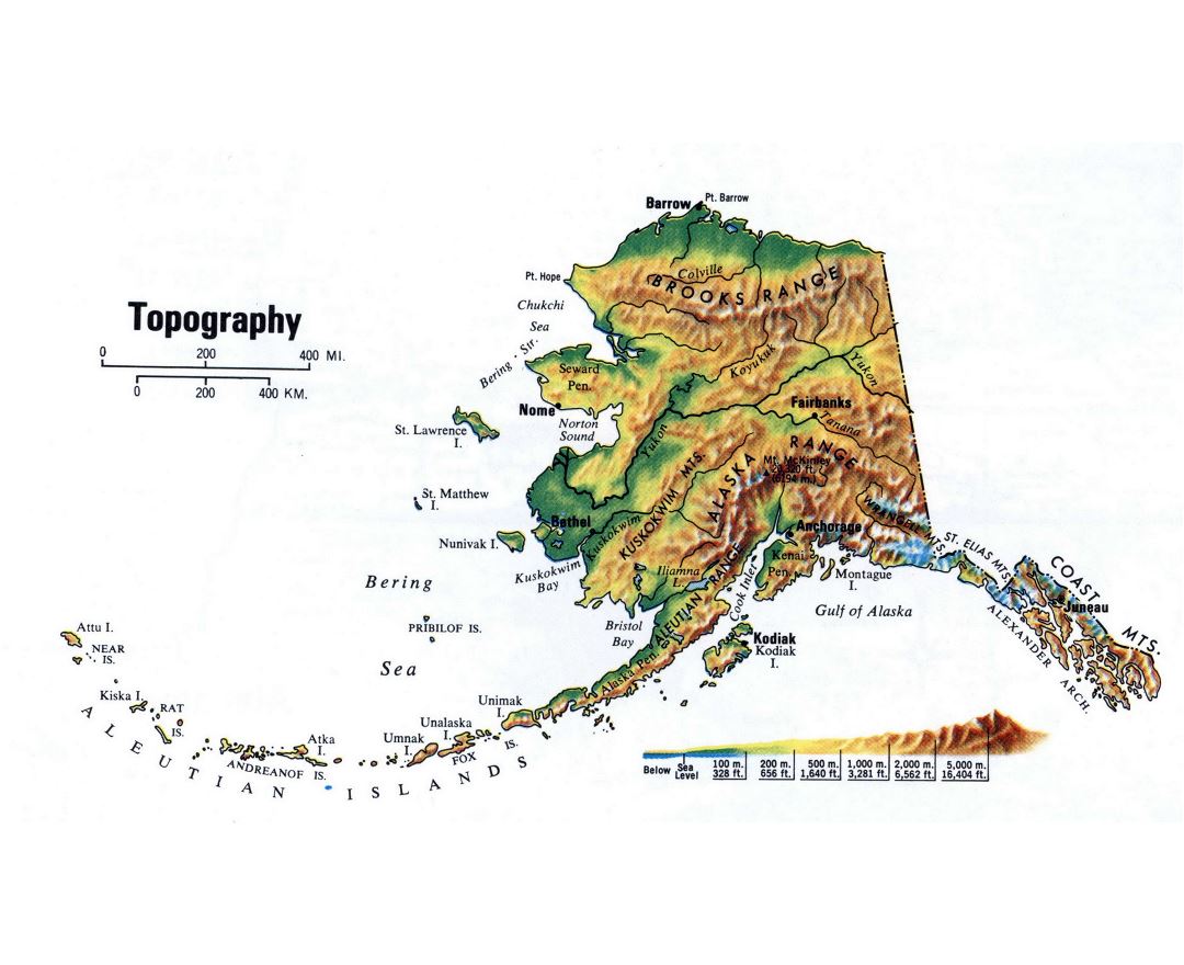
Alaska is a U.S. state situated in the northwest extremity of the Americas. The Canadian administrative divisions of British Columbia and Yukon border the state to the east; it has a maritime border with Russia to the west across the Bering Strait. To the north are the Chukchi and Beaufort seas–the southern parts of the Arctic Ocean. The Pacific Ocean lies to the south and southwest. Alaska is the largest state in the United States by area, the 3rd least populous and the least densely populated of the 50 United States. Approximately half of Alaska's residents (the total estimated at 738,432 by the U.S. Census Bureau in 2015) live within the Anchorage metropolitan area. Alaska's economy is dominated by the fishing, natural gas, and oil industries, resources which it has in abundance. Military bases and tourism are also a significant part of the economy.
The United States purchased Alaska from the Russian Empire on March 30, 1867, for 7.2 million U.S. dollars at approximately two cents per acre ($4.74/km²). The actual transfer of sovereignty took place on the 6th October 1867 (Julian calendar), which was equivalent to the 18th October in the Gregorian one. To complicate matters further, the time zone changed from 14 hours ahead of Greenwich to 10 hours behind, which meant that Alaska had two Fridays in succession, the only place to have ever done so. The area went through several administrative changes before becoming organized as a territory on May 11, 1912. It was admitted as the 49th state of the U.S. on January 3, 1959.